As of Jun 19, 2026, 8:24 PM, peak season now, through ~August 15. Earth Exhibit tracks the live conditions and flags it the moment it is on.
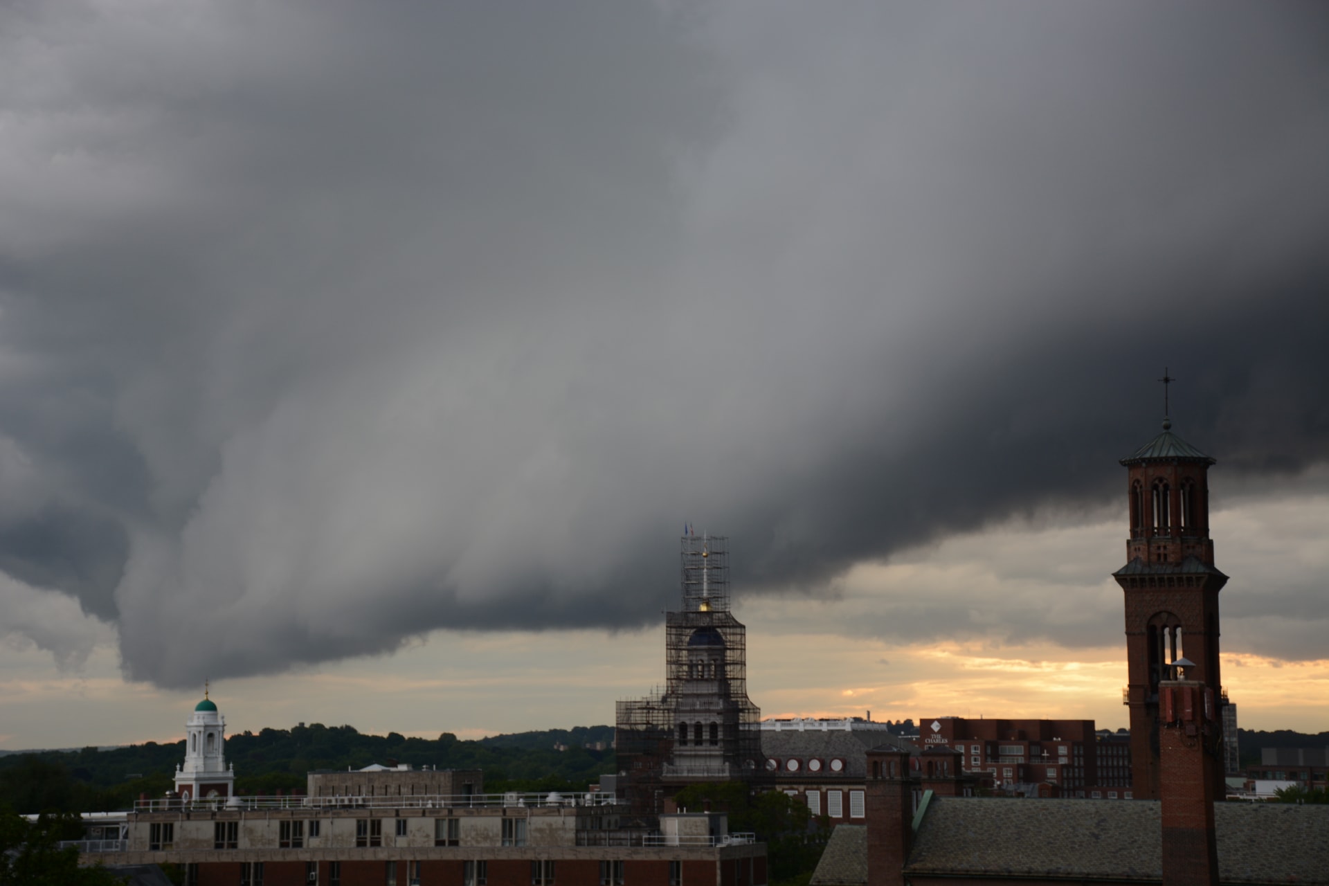
A shelf cloud is the National Weather Service's name for a low, horizontal, wedge-shaped arcus cloud attached to the base of a thunderstorm — the leading edge of the storm's outflow, or gust front, made visible.
As rain-cooled air descends and spreads out beneath the storm, it shoves under the warm, moist air ahead of it; that warm air is forced up the leading edge and condenses into a smooth, ominous ledge that can stretch from horizon to horizon.
Watch one approach and the underside often looks turbulent and layered while the top is smooth — it is the boundary between the storm's downdraft and its inflow.
A shelf cloud is a warning, not a spectacle to chase: the damaging straight-line winds, dust, and the heaviest rain arrive seconds to a few minutes behind it.
The most photogenic examples roll across the open Great Plains and along the Great Lakes shorelines, where an unobstructed horizon reveals the full sweep of the arc.
Where to see it
A taste of where to see it. The full map, exact coordinates and the best timing for each spot live in the app.
| Viewing spots |
|---|
| Chicago Lakefront (Lake Michigan), Illinois |
| Edgewater Park (Lake Erie), Cleveland, Ohio |
| + 1 more spot, with exact coordinates and timing, in the app → |
This is the short version
This page shows a taste. The app has the full list of where to see this, the exact timing, and live conditions for 1,000+ natural phenomena worldwide, so you know the moment one is genuinely worth the trip.