As of today, in season, building toward peak (~July 1). Earth Exhibit tracks the live conditions and flags it the moment it is on.
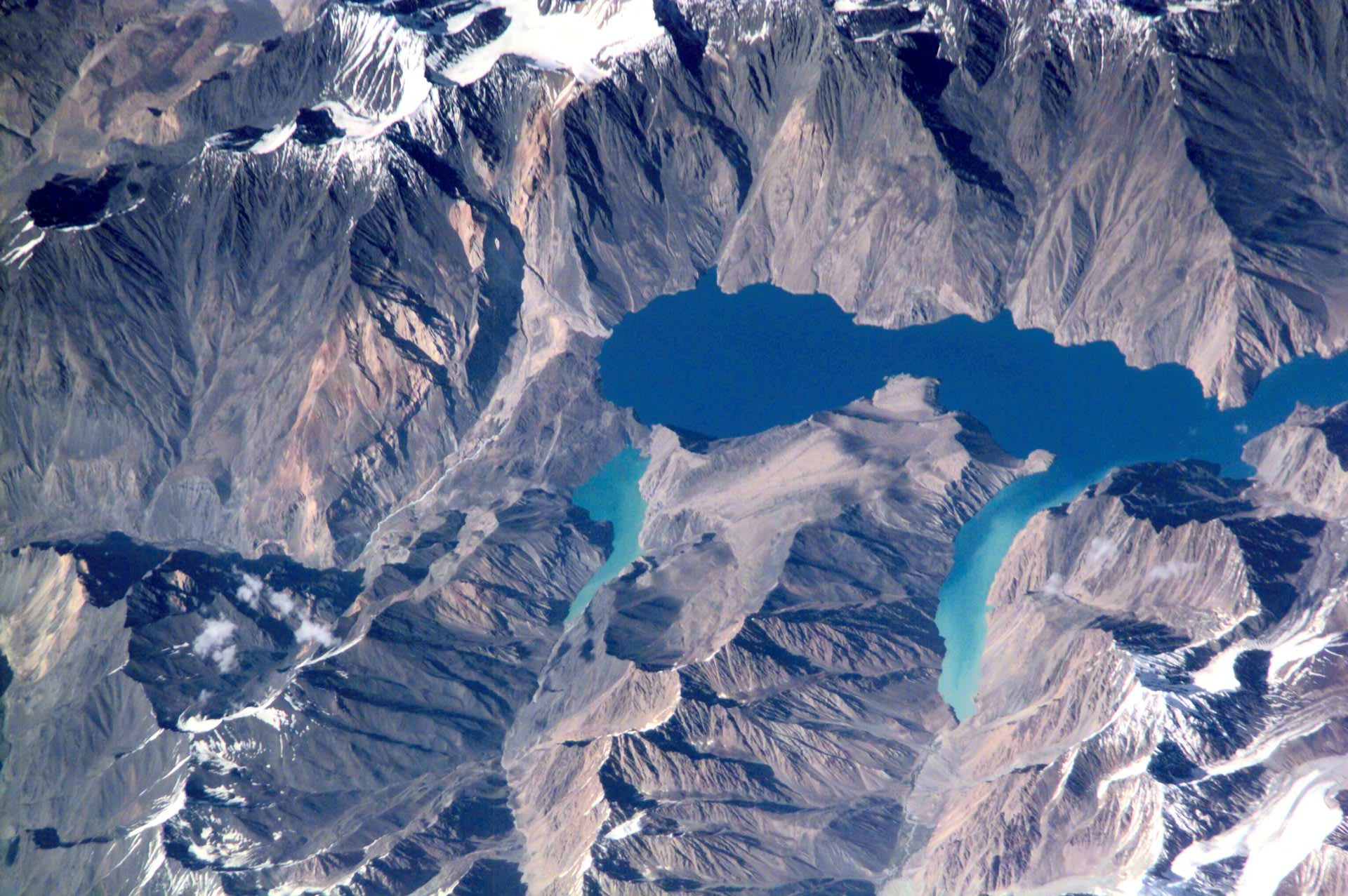
On the night of February 18, 1911, a powerful earthquake shook the high Pamirs of Tajikistan and tore an entire mountainside loose.
The landslide, one of the largest in recorded history, buried the village of Usoi and slammed across the Murghab valley, plugging the river with a rock barrier rising about 567 metres from the old valley floor, taller than any dam ever engineered.
Behind it the water rose for years, drowning villages and filling the gorge to create Lake Sarez, a sinuous, blue alpine lake stretching roughly 75km through some of the most remote terrain on the planet at over 3,200 metres elevation.
The setting is severe and silent: bare ochre slopes, snow peaks, and water so deep and still it mirrors the ridgelines.
The lake carries a famous unease, since hydrologists have long studied whether the natural Usoi Dam could one day fail and send a flood down the Bartang valley, and the site is monitored for exactly that reason.
Reaching it is a genuine expedition through permit-controlled mountains, which is why almost no one stands on its shore.
Where to see it
A taste of where to see it. The full map, exact coordinates and the best timing for each spot live in the app.
| Viewing spots |
|---|
| Usoi Dam & Lake Sarez Shore |
This is the short version
This page shows a taste. The app has the full list of where to see this, the exact timing, and live conditions for 1,000+ natural phenomena worldwide, so you know the moment one is genuinely worth the trip.