As of today, out of season, returns ~November. Earth Exhibit tracks the live conditions and flags it the moment it is on.
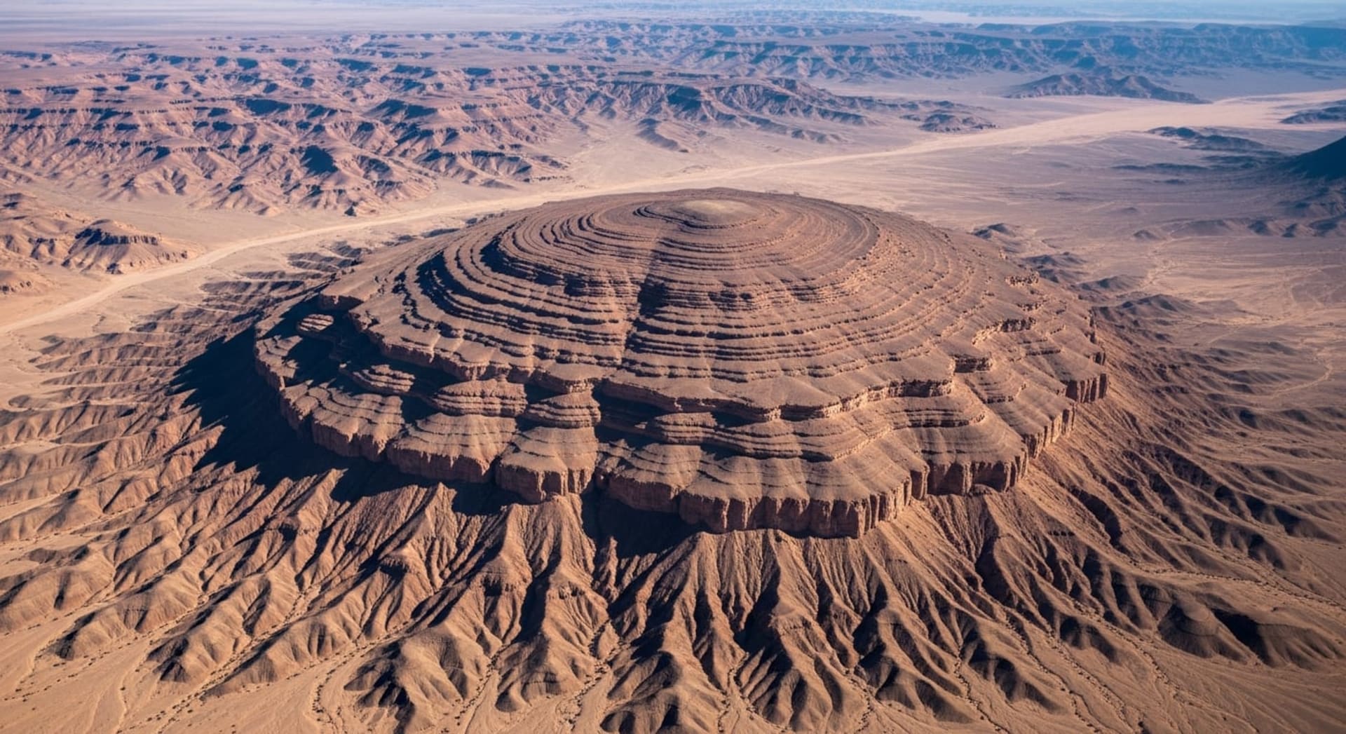
The Richat Structure is a deeply eroded geological dome roughly 40 kilometers in diameter on the Adrar Plateau of central Mauritania.
Concentric rings of differentially eroded sedimentary and igneous rock create a striking bullseye pattern that is unmistakable from space.
The structure formed when a Cretaceous-age alkaline igneous intrusion uplifted overlying Proterozoic-to-Ordovician sedimentary layers into a dome; millions of years of wind, sand, and water erosion then stripped softer rock away, leaving resistant quartzite ridges standing as circular cuestas.
Initially mistaken for a meteorite impact crater, field studies in the 1960s found no shock metamorphism and confirmed a purely terrestrial origin.
The IUGS designated it one of 100 geological heritage sites worldwide in October 2022.
Where to see it
A taste of where to see it. The full map, exact coordinates and the best timing for each spot live in the app.
| Viewing spots |
|---|
| Richat Structure Center (Ground Exploration) |
| Ouadane (Base Town) |
| + 1 more spot, with exact coordinates and timing, in the app → |
This is the short version
This page shows a taste. The app has the full list of where to see this, the exact timing, and live conditions for 1,000+ natural phenomena worldwide, so you know the moment one is genuinely worth the trip.