As of today, peak season now, through ~September 15. Earth Exhibit tracks the live conditions and flags it the moment it is on.
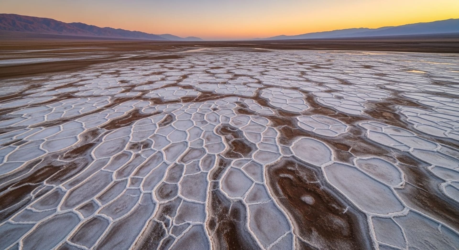
Regular polygonal salt plates and low ridges form across the playas of Dasht-e Kavir when groundwater and ephemeral surface water evaporate and precipitate salts.
The patterns result from surface salt crust growth coupled with subsurface porous-media convection and desiccation, producing meter-scale polygons and raised rims visible from the ground and satellite platforms.
Where to see it
A taste of where to see it. The full map, exact coordinates and the best timing for each spot live in the app.
| Viewing spots |
|---|
| Maranjab Caravanserai (viewpoint for Namak Lake) |
| Namak (Salt) Lake playa - central Namak basin viewpoint |
| + 1 more spot, with exact coordinates and timing, in the app → |
This is the short version
This page shows a taste. The app has the full list of where to see this, the exact timing, and live conditions for 1,000+ natural phenomena worldwide, so you know the moment one is genuinely worth the trip.